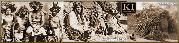
KUMEYAAY Sovereign Tribal Governments
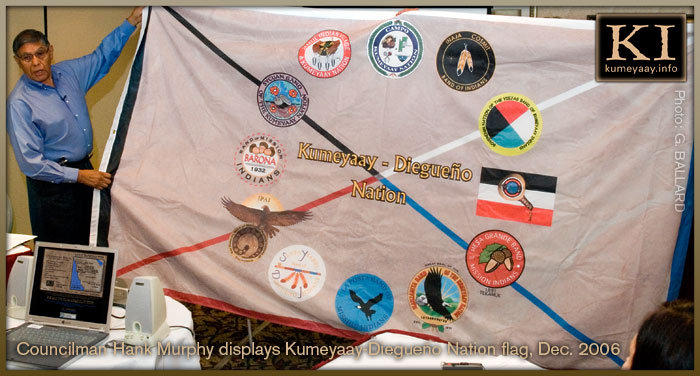
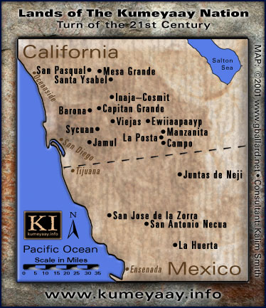
Southern California tribes, the 13 Kumeyaay bands:
- Campo Band of the Kumeyaay Nation
Viejas Band of Kumeyaay Indians
Barona Band of Mission Indians
San Pasqual Band of Indians
Inaja Cosmit Indian Reservation
Capitan Grande Indian Reservation
Santa Ysabel Band of Diegueño Indians, aka Iipay Nation of Santa Ysabel
Ewiiaapaayp Band of Kumeyaay Indians aka Cuyapaipe
Manzanita Indian Reservation
La Posta Indian Reservation
Jamul Indian Village A Kumeyaay Nation
Mesa Grande Indian Reservation
Sycuan Band of the Kumeyaay Nation
HOW TO CONTACT the San Diego County tribal governments:
BARONA, CAHUILLA, CAMPO, CHEMEHUEVI, EWIIAAPAAYP, INAJA-COSMIT, JAMUL, LA JOLLA, LA POSTA, LOS COYOTES, MANZANITA, MESA GRANDE, PALA, PAUMA, RINCON, SAN PASQUAL, SANTA YSABEL, SYCUAN, VIEJAS
Baja California, Mexico, Kumiai bands tribes:
- San Jose de la Zorra
La Huerta
Juntas de Neji
San Antonio Necua
Santa Catarina (Kumeyaay-Pai Pai)

KUMIAI DE BAJA CALIF MEXICO en Español Kumiais una cultura en riesgo de extinsión, Acerca de los indigenas Kumiai, Geografia, Sistema Politico, Origenes lingüisticos, Programas de Trabajo, Consejo, Acerca de los indigenas Kumiai, Gobernadora Kumiai, Origenes lingüisticos, y mucho mas...
|