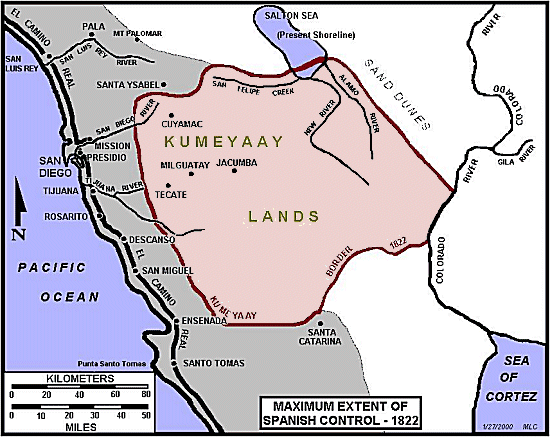
KUMEYAAY LANDS MAP 1822 Spanish Control in San Diego
This Mike Connolly Miskwish, Campo-Kumeyaay website historical map "Maximum Extent of Spanish Control, 1822" graphic details the Kumeyaay tribal lands and the expanding Spanish control of San Diego, California, 1822.
LOST INDIGENOUS COASTAL LANDS
By 1822, the Kumeyaay Indian peoples had lost control of all their ancestral tribal coastal lands to the European immigrants.
This historical map graphic is being used by the KUMEYAAY.INFO website in its Kumeyaay Maps and Kumeyaay History online sections.
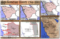
Five more MIKE CONNOLLY MISKWISH Campo Maps may be accessed here.
These five historical Kumeyaay maps detail Kumeyaay points of history:
• The arrival of the Spanish in San Diego 1769
• The Spanish expansion into Kumeyaay Indigenous tribal territory 1798
• The maximum extent of Spanish control in San Diego 1822
• The Kumeyaay attacks on the Spanish to regain their lands 1836-1842
• The Treaty of Santa Ysabel 1852
Five more Mike Connolly Miskwish (Campo) Maps may be accessed from KUMEYAAY.INFO.
These five maps detail Kumeyaay points of history, the arrival of the Spanish 1769, the Spanish expansion into Kumeyaay Indigenous territory 1798, the maximum extent of Spanish control 1822, the Kumeyaay attacks on the Spanish to regain their lands 1836-1842, the Treaty of Santa Ysabel 1852.
|