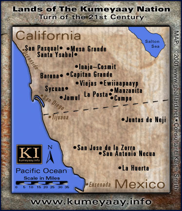
Home
Museums

KUMEYAAY INDIAN RESERVATIONS MAPS

KUMEYAAY MAP 2005
DOWNLOAD "Lands of The Kumeyaay Nation" Map Poster
.

KUMEYAAY.INFO provides a high-resolution 8x9-inch printable JPEG Kumeyaay Map in its Press Kit — FOR NON-PROFIT EDUCATIONAL USE ONLY.

GARY G. BALLARD built the Kumeyaay Nation map of the California Indian homelands from scratch using Adobe® Photoshop®. Map © 2001 G. BALLARD • ALL RIGHTS RESERVED • Kumeyaay map includes the 13 federally-recognized Kumeyaay Indian reservations in Southern California, San Diego County, and the four Kumiai tribal villages ejidos rancheros rancherias rural ranchos Indigenous community ranches in northwest Baja California, Mexico.
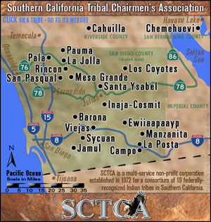
The original high-resolution Master .psd file is over 450 megabytes.
The Master file is fully editable and will print vector sharp over 48-inches wide.
Stock Image rights available.

CURRENT KUMEYAAY BANDS:

UNITED STATES Southern California Kumeyaay reservations Kumeyaay bands:

Sycuan Band of the Kumeyaay Nation
Mesa Grande
Viejas Band of Kumeyaay Indians
Barona Band of Mission Indians
Capitan Grande
Santa Ysabel Band of Diegueño Indians
San Pasqual Band of Indians
Inaja Cosmit
Ewiiaapaayp Band of Kumeyaay Indians Cuyapaipe
Manzanita
La Posta
Jamul Indian Village
Campo Band of the Kumeyaay Nation

BAJA CALIFORNIA MEXICO Kumeyaay tribes Kumeyaay bands Kumiai community:

San Jose de la Zorra
San Antonio Necua
La Huerta,
Santa Catarina (Kumeyaay Paipai Pai-Pai)
Juntas de Neji

INDIGENOUS INDIANS OF GREATER SAN DIEGO COUNTY MAP:

LUISENO Luiseño Indian bands:

La Jolla, Pala Band of Mission Indians, Rincon San Luiseno Band of Mission Indians, Pechanga Band of Luiseno Indians, Pauma Yuima...

CAHUILLA CUPENO bands:

Los Coyotes Band of Mission Indians Cahuilla Cupeno Indians Cupeño, Warner Springs, CA

COCOPAH Cucapa:

Cocopah Indian Tribe, Somerton, AZ
Cucapa Indian village, El Mayor, Baja California, Mexico

QUECHAN:

Fort Yuma Indian Reservation, Winterhaven, CA

MAP OF ALL SAN DIEGO NATIVE AMERICAN INDIAN CASINOS IN SOUTHERN CALIFORNIA

INDIAN CASINOS MAP

SOCAL Casino & Tribes 2012

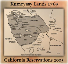
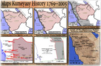
HISTORICAL Southern California Indian Maps 1700s 1800s 1900s

Indian Reservations
A Mike Connolly Miskwish (Campo) Kumeyaay Map
details all the 2005 Indigenous California Indian tribes, the Native American Indian reservations of the greater Southern California area, and contrasts them with the Indigenous Kumeyaay territory of 1769.

Historical Maps
Five more Mike Connolly Miskwish (Campo) Maps
may be accessed from KUMEYAAY.INFO.
These five maps detail Kumeyaay points of history, the arrival of the Spanish 1769, the Spanish expansion into Kumeyaay Indigenous territory 1798, the maximum extent of Spanish control 1822, the Kumeyaay attacks on the Spanish to regain their lands 1836-1842, the Treaty of Santa Ysabel 1852.

Terms of UsePrivacy StatementSite Map
Kumeyaay Indians Home
About UsMission StatementPress KitContact Us